|
Subdivision II. – Height
Sec. 4-1871. – Measurement.
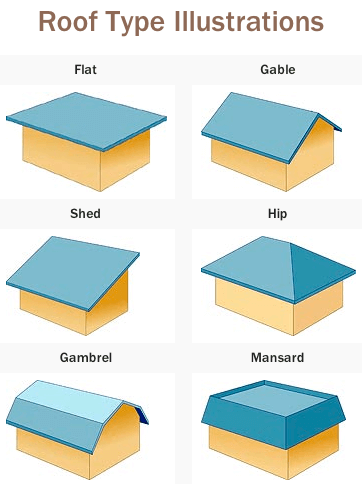
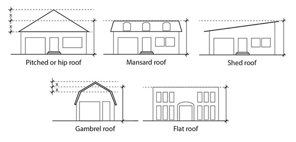
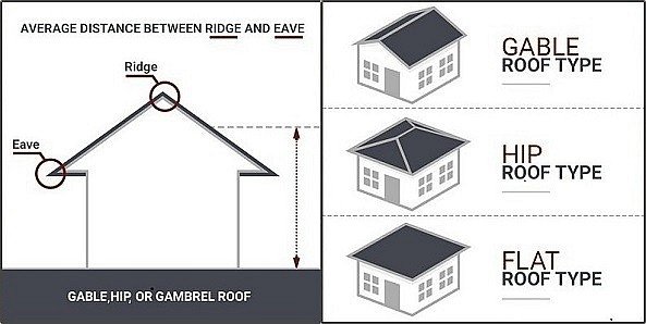
- Except as provided in this subdivision, the height of a building or structure is measured as the vertical distance from grade to the highest point of the roof surface of a flat or Bermuda roof, to the deck line of a mansard roof, and to the mean height level between eaves and ridge of gable, hip and gambrel roofs, and to the highest point of any other structure, excluding fences and walls. For purposes of this subdivision, the term “grade” is the average elevation of the street or streets abutting the property measured along the centerline of the streets, at the points of intersection of the streets with the side lot lines (as extended) and the midpoint of the lot frontage.
- In areas within the coastal building zone and other floodprone areas (as defined in chapter 5, articles III and IV), height of a building is the vertical distance from the minimum required flood elevation to the highest point of the roof surface of a flat or Bermuda roof, to the deck line of a mansard roof, to the mean height level between eaves and ridge of gable, hip and gambrel roofs.
- Fences, walls, and buffers are measured in accordance with sections 4-1467 and 3-418.
- This section does not apply to the height limitations for special areas for Bonita Beach and Little Hickory Island.
Sec. 4-1872. – Exception to height limitations for certain structural elements.
Sec. 4-1873. – Additional permitted height when increased setbacks provided.
Sec. 4-1874. – Height limitations for special areas.

Height measured from grade or base flood elevation (BFE)


|
